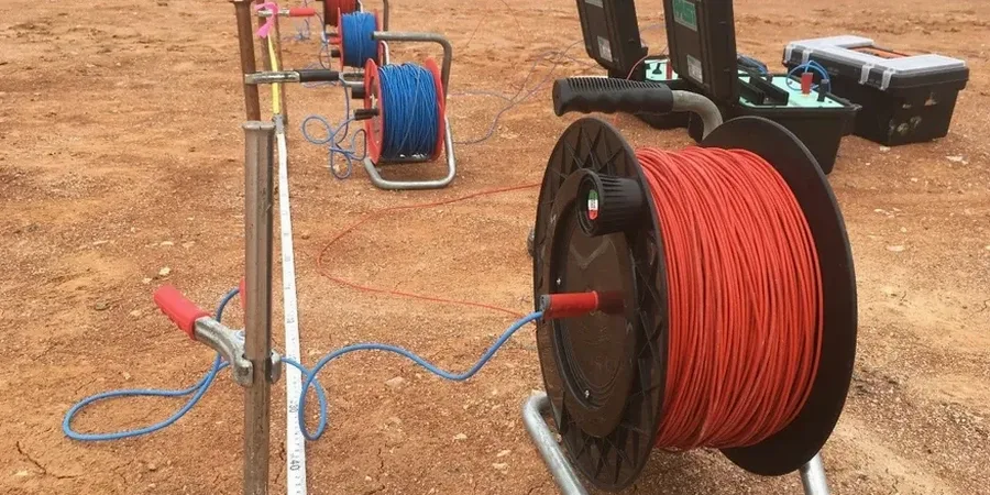
We often get calls after a project hits unexpected groundwater or finds buried channel deposits that standard borings missed. Moreno Valley sits on the complex alluvial fan where the Box Springs Mountains meet the former floodplain of the San Jacinto River. This geology creates abrupt lateral changes in soil type, from coarse gravel stringers to fine silts, over very short distances. A few test pits or SPT borings provide point data, but they do not show the continuity between holes. Vertical electrical sounding fills that gap. We run a series of expanding electrode arrays to map resistivity changes with depth. The resulting profile reveals where saturated zones begin, where coarse granular layers pinch out, and where clay lenses might cause differential settlement. For Moreno Valley projects near the March Air Reserve Base area or along the 60 freeway corridor, combining a few strategically placed SPT drill holes with a VES survey gives a much clearer picture than either method alone.
In the alluvial fan environment of Moreno Valley, a VES survey maps the continuity of coarse-grained layers that control both bearing capacity and drainage characteristics.
Our approach and scope
Moreno Valley's semi-arid climate creates a specific challenge for resistivity surveys. The surface soils are often bone-dry and highly resistive, particularly during the long summer months from June through October when rainfall is virtually zero. High contact resistance at the electrodes can degrade data quality if not properly managed. Our field crew routinely pre-soaks electrode locations and uses bentonite slurry to improve coupling in the dry sandy loam common across the eastern part of the city. Once we break through that dry crust, the resistivity contrast between unsaturated and saturated zones becomes sharp and interpretable. This is ideal for mapping the depth to groundwater across large sites, such as warehouse developments in the industrial areas north of the 60 freeway. The same principle applies when delineating the extent of clay layers. Saturated clays show very low resistivity values, often below 10 ohm-m, while dry sands and gravels can exceed 200 ohm-m. That contrast allows us to map subsurface stratigraphy across a site without needing a dense grid of borings. We run both Schlumberger and dipole-dipole arrays depending on the target depth and the required lateral resolution.
Local ground factors
The San Jacinto fault zone runs just a few miles northeast of Moreno Valley. The city is classified under Seismic Design Category D per ASCE 7, meaning significant ground shaking is expected. One of the less obvious risks on alluvial fan deposits is the potential for liquefaction in saturated sandy layers. The California Geological Survey has mapped portions of the valley floor as having moderate to high liquefaction susceptibility. A resistivity survey helps identify those saturated granular zones by their intermediate resistivity signature, typically between 25 and 100 ohm-m, sandwiched between more conductive clays. If those layers are continuous and shallow, the geotechnical report must address them. We have seen projects where ignoring these zones led to expensive foundation redesigns after grading exposed unexpected groundwater and loose sands. The IBC requires site-specific hazard analysis for structures in Seismic Design Category D, and resistivity data contributes to a defensible ground model that satisfies the reviewing agency in Riverside County.
Common questions
What does a VES survey cost for a typical Moreno Valley project?
For a standard single-location Vertical Electrical Sounding with depth investigation up to 100 feet, costs generally range from US$590 to US$1,140 depending on site access, electrode array configuration, and the level of interpretation required. Larger 2D tomography lines or multi-point surveys are quoted based on linear footage and electrode spacing.
How deep can electrical resistivity surveys investigate in Riverside County soils?
With the Schlumberger array, we routinely achieve investigation depths of 30 to 100 meters (100 to 330 feet) in Moreno Valley's alluvial deposits. The actual penetration depends on the maximum electrode spacing deployed and the subsurface resistivity contrast. In very dry surface conditions, we pre-soak electrodes to improve current injection and maintain data quality at depth.
Can resistivity surveys tell the difference between clay and saturated sand?
Yes, and this is one of the main reasons we use them. Saturated clays typically show very low resistivity values, often below 10 ohm-m, because clay minerals hold water and conduct electricity well through surface conduction. Clean saturated sands range higher, usually 30 to 100 ohm-m, because conduction occurs only through the pore water. Dry sands and gravels can exceed 200 ohm-m. We calibrate these values against boring logs to confirm the interpretation.
What surface conditions can cause problems for a resistivity survey in Moreno Valley?
The biggest challenge here is the dry, compacted surface soil during summer and fall. High contact resistance reduces current flow into the ground. We manage this by pre-soaking electrode holes with saline solution and using bentonite slurry for better coupling. Buried utilities, reinforced concrete slabs, and metallic fencing can also introduce noise. We always conduct a site walkover before the survey to identify and avoid these interference sources.
How long does a typical VES survey take on site?
A single VES sounding at one location usually takes 45 to 90 minutes of field time, including electrode layout, measurement, and breakdown. A 2D tomography line several hundred feet long might take half a day. We provide preliminary results within 48 hours and a full report with inversion models and interpreted cross-sections within five business days.